Maps
What is it?
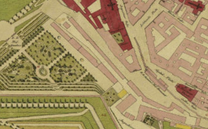
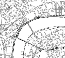
A map is a representation of a place or space in pictorial form. Map literacy fosters not just geographic awareness, but also a sophisticated understanding of topography, navigation, and spatial relationships. This skillset empowers individuals to not only navigate the physical world, but also to mentally map complex systems and concepts. By interpreting symbols, navigating routes, and constructing mental models, we develop crucial cognitive skills applicable to problem-solving, decision-making, and even scientific analysis.
Map Creating
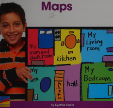
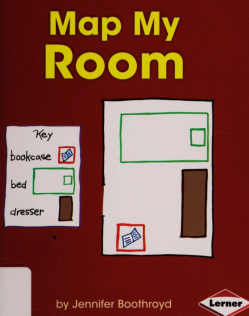
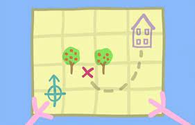 Create a map of your house, to start young kids with the understanding of spacial representation. For us, it is completely clear, but for young kids, it needs to be established that you can represent your space on paper. Maps are indispensable tools for navigating the world and fostering cognitive development. By studying maps, children cultivate spatial reasoning skills, enabling them to comprehend the relationships between places and objects. This enhances their critical thinking abilities, as they learn to analyze information, make inferences, and solve problems effectively. Moreover, maps broaden children's global awareness, exposing them to diverse cultures and environments. They become adept at problem-solving, such as finding the shortest route or locating a place based on descriptions. Ultimately, maps serve as powerful communication tools, facilitating the exchange of information and ideas. Through map exploration, children develop essential skills that will prove invaluable throughout their lives.
Map reading can be considered a preskill to reading, as it links in the child's mind that what they see on the page has meaning.
Map making skills start children noticing the world around them. After your house, try making a map of your street and then your neighborhood. You might find new interesting stores or play areas that you hadn't noticed before!
![]() Activity! Understanding Scales
Activity! Understanding Scales
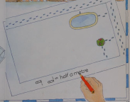 Before you can use a grid, consider using measuring out a path with your child's feet - ask the child to count steps (heel to toe) from the door to the bed (and so on), while you draw out a map (following these dimensions). Later, use this map with the grid where each grid square is one foot.
![]() Activity! Use a Grid
Activity! Use a Grid
Use a simple grid to help conceptualize sizes. Create a map of a room together - livingroom or kitchen, looking at the room,  ask the child to go to a place and stand next to a thing (ie fridge). Then draw it on the map. Ask child to check your work. Swap roles.
![]() Activity! Grid Drawing
Activity! Grid Drawing
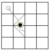 If you are having trouble drawing on grids, try starting out with grid drawing. grid.pdf
![]() Activity! Grid Game
Activity! Grid Game
And here is a quick (2 minutes) game to explain the grid map system!
Grid worksheet, if you are so inclined.
![]() Activity! Battleship - A Grid Game
Activity! Battleship - A Grid Game
If you are having trouble understanding grids and how to use them, try a quick game of battleship. Print it out (battleship.pdf) or try it online
![]() Activity! Hurkle
Activity! Hurkle
(from Family Math)
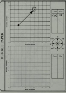
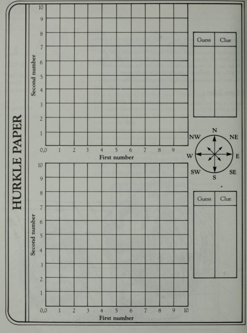
Using the Hurkle paper, one person is the leader who decides where the Hurkle is place (hiding). Other guess coordinates (ie 2,4). Leader gives a clue of direction (ie go Northeast).
![]() Activity! Make A Map of The Room
Activity! Make A Map of The Room
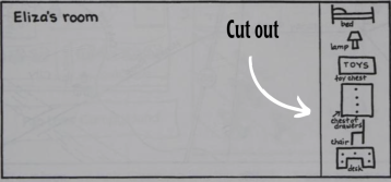
Make an outline of the room in simple squares. Create simple shapes to represent things in the room. Cut these out and let child glue them on the map where there things are. Title the map. For a reusable map, cover in clear packing tape. Use a whiteboard marker (erasable) to draw the X's on map in the next activities!
![]() Activity! Toy Hunt
Activity! Toy Hunt
Take a favorite toy and place it somewhere unusual, but still visible (ie up high). Draw an x on the map you made together. Ask child to find the toy. Try it a few times. Another day hide the toy out of sight. Draw an x on the map you made together. Ask child to find the toy.
![]() Activity! Aerial View
Activity! Aerial View
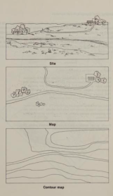 On the floor next to a couch or bed, create a village or town using blocks, magnets and or boxes. Add tenants to live in each building. After playing for a few minutes (or hours, depending on child's inclination), sit up high (on the couch or bed), with paper and pencil - begin creating an aerial view. Allow the child to make mistakes and ask if they would like to change the town to fit the map. What details could we add to make note of who lives where?
![]() Activity! Treasure Hunt
Activity! Treasure Hunt
Got some small wrapped candy (chocolate coins make it feel like a treasure hunt, but any wrapped candy will do)? Hide it where it can be seen, make a map (or use one you already made), X marks the spot. Do it again on another day but hide it where it cannot be seen and mark it on the same or similar map.
![]() Activity! Get Serious About Map Making
Activity! Get Serious About Map Making
Give kid(s) your phone and let them hide it while drawing a map themselves or using the one you made together. Remind them to mark an x on the map!!
![]() Activity! Tea Party Place Planner
Activity! Tea Party Place Planner
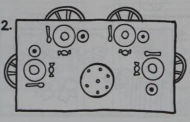 Gather the animals!! Prepare the tea and biscuits (or what have you). Make a detailed map of where everything will go and see if child can replicate it in real life. tea-party-map-example.pdf
![]() Activity! Larger, Bigger
Activity! Larger, Bigger
Start mapping things like the way to school, your street, a park you frequent. Remember to consider the difficulty of looking at the real big things and representing them in a small map. Start with the simplest of maps, allowing child to add as they please. Talk about the idea of 'landmarks.' What makes a good landmark to put on a map?
![]() Activity! Map Symbol Bingo
Activity! Map Symbol Bingo
Map Symbol Bingo , symbol match and Find the Map Symbols!
![]() Activity! Key Game
Activity! Key Game
 Make a key for a map of your most popular playground with an empty space where the child can draw. Make the objects in the key easy to reproduce. Talk about what they are, then let the child try to recreate them on the map.
![]() Activity! Sensory Moments
Activity! Sensory Moments
 To start your child noticing their surroundings, try this activity. It all starts with going for a walk! When you find a place you want to explore, say that you want to stop and do an activity here. We are going to take some time and explore this area with our senses. At first, the child might want to play. Give plenty of time to do so. Playing is just another form of learning for kids. It's not necessary to force them to focus on every sense at once; let them guide the experience.
Exploring with Your Senses worksheet
- Smell: Can you smell anything? Is it a pleasant or unpleasant scent?
- Look: What do you see around you? Notice colors, shapes, and patterns.
- Listen: Be quiet for a moment. What sounds do you hear? Try to list them all.
- Touch: Are there interesting textures nearby to explore?
By taking a moment to engage your senses, you and your children can experience your surroundings in a new way. This isn't about stopping playtime, but about adding a layer of awareness and curiosity to your outdoor adventures. When you do pause, use this opportunity to learn and appreciate the little details that often go unnoticed. By adding a new layer of exploration to your outdoor adventures, you're teaching them the value of observation and appreciation for the world around them. This simple act can turn any outdoor excursion into a learning experience, all while maintaining the joy and freedom of play.
![]() Activity! Global
Activity! Global
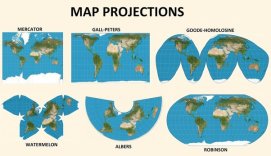
Because of the nature of a sphere, and colonialism, maps of the past don't necessarily represent the real size of continents - When learning about the globe - check your perspective at True Size; you can take a country and see how it relates in size to another country!
![]() Activity! Smell Map
Activity! Smell Map
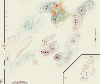
After getting really good at making maps using sight as the main component, ask child to create a smell map! You could try walking a small area repeatedly or stopping and noting with a larger area. Consider places a smell map might be easy to make and places it would be hard. After you realize a smell, draw it using one color. What color best represents this smell? Why? How big should this smell's area be?
![]() Activity! Sound Map
Activity! Sound Map
Like a smell map, a sound map captures the different noises around. Talk about the idea of 'ambient' noise (or noises that are some how in the background of our lives). How can I represent these sounds? What are the main components? What color best represents this particular sound? Ho big is the area represented by this sound?
![]() Activity! Plant and Animal Map
Activity! Plant and Animal Map
Ask child to create a map of an area that focuses on plants or animals or both, depending on the child's interest.
![]() Activity! Wonder Map
Activity! Wonder Map
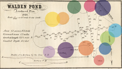
Ask child to draw a map highlighting landmarks, things of interest that happened, things they wonder about or anything else that strikes their fancy. This can be a map of a real physical place with their take on what is of interest or a fictional place, sculpted to their wonderment and fancies.
![]() Activity! Map Your Neighborhood
Activity! Map Your Neighborhood
 Make your own small map of your neighborhood. Start with one direction (use a compass), making notes on your map as you find interesting things. Activity Sheet
Three Dimensional Maps:
When learning about new cultures, or your own, start by creating a 3D map of the country. Remember to at least note bordering countries to help later establish where on the globe the created map should go.
![]() Salt Dough Maps!
Salt Dough Maps!
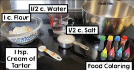 Equal parts flour and salt, blend. Add just enough water to make a playdough like consistency. If you have food coloring, you could use that to change the color of the dough. If you don't, try painting the dough after it has dried.
![]() Activity! Play-dough Map
Activity! Play-dough Map
To make your map, you could use play-dough with blue for water, greens, yellows, browns for grounds.
You could print out the country you want to make the map of, using a typography style one to indicate peaks and valleys. Construct the cookie dough on it, remove the paper and bake it. Then paint it with sugar paint!
![]() Paper Mache Maps!
Paper Mache Maps!
 This requires making the glue as well, which is just flour and water. You can make anything with paper mache, including bowls, masks and other things.
Navigation Games
![]() Activity! Left Right Stop
Activity! Left Right Stop
In a familiar playground, at home, or other well-known location set a goal - navigate child using only "left," "right" and "stop." Important! Play again - this time the child gets you to the goal using only "left," "right" and "stop."
![]() Activity! Learn to Use a Compass
Activity! Learn to Use a Compass

![]() Activity! NSEW
Activity! NSEW
Start learning North, South, East and West with a game of directions that uses these terms and a compass. So the child holds the compass and you direct them to the set goal using North, South, East and West. If possible, take the time to switch roles!
![]() Activity! Map Ball (Ordinal Directions Game)
Activity! Map Ball (Ordinal Directions Game)
(from Eureka)
On a basketball court, make with chalk or cones two points (north and south, without noting which is which, using a compass). Call out North, Northeast, East, Southeast, South, Southwest, West, Northwest (ordinal directions). Player must find their position (based on the two points you placed). If it is right, they get two points, and a chance to shoot a basket. If wrong, no points and no shot. Depending on child's basketball level - decide how many turns will be taken. Keep count of points and challenge child to play another time and beat their own score!
![]() Activity! Opposite SatNav
Activity! Opposite SatNav
Using a navigation device, insert a location you want to go. Then don't follow the directions.! In fact, do the opposite of what the navigation says!
![]() Activity! Child SatNav
Activity! Child SatNav
Turn off your navigation on your phone or in your car. Allow the child to direct you until you are good and properly lost. Use a map (preferably paper but if you use the phone map, turn off your location finder), to try and find your way home.
- Understanding where north is could be really helpful at this point.
- Consider investing in a simple compass.
- Try to let the child have some time to figure it out on their own.
![]() Activity! Child Led Trip (small)
Activity! Child Led Trip (small)
Let the child plan a trip in your own city or town with maps, deciding where and how to get from each desired site to the other.
- Even if you think you know a better way to go, follow the child's direct.
- Allow it to take as long as it takes.
- Bring extra water and food.
![]() Activity! Child Led Trip (big)
Activity! Child Led Trip (big)
Go to a part of town you are not familiar with or a new city, town etc. Explore using a map. Remember to teach your child: 1) Landmarking and directions (Where is North? What landmark is there?) 2) Keep track of the sun/ time - It's harder to see in the dark 3) How much water you have - what keeps you clear, less likely to panic 4) How much gas you have (and how far you are from being able to get more) 5) Food - Hungry people usually don't struggle well.
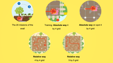
![]() Activity! Coding and Maps
Activity! Coding and Maps
![]() Activity! Lost
Activity! Lost
Teach what to do if you get lost in a physical space
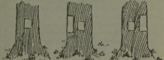
Following the Native American's example, consider teaching marking a path -
Orientation - The Sport
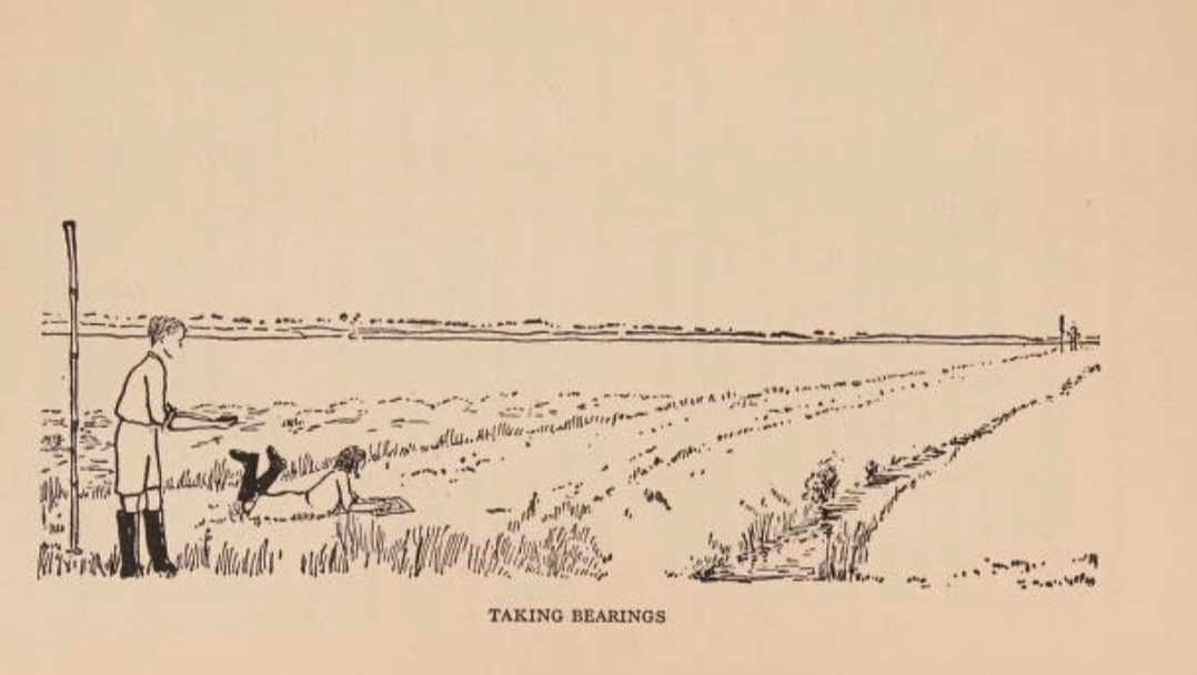
The main idea - is to get from one place to another using the shortest most efficient route. Decide on the two places based on the skills of the participants. For beginners, it's best to set up in a familiar territory- a city or park. Set up checkpoint flags throughout the course, as you pass one, you mark it down on your map.
What you learn - read landscapes. Participants are constantly forced to make navigation decisions. And ability to read a map - where am I and which way do I need to go.
 Consider investing in a compass that makes it easier to read and calculate true North - for beginners - referred to sometimes as an Orienteering Compass. It should cost around 10 US dollars, though more expensive ones are available. These are made to work with a paper map.
 Love map making? Love orienteering? Love GEOcaching? Want to make a course/series/class for kids with me? Contact me @ admin@parkfuturesedu.com
Resources
- Google Earth Education:
- All About Maps for Kids:
- Ordnance Survey Mapzone:
- National Geographic Kids Countries:
